Traveling – it leaves you speechless, then turns you into a storyteller
Ibn Battuta
South Patagonia within Argentina
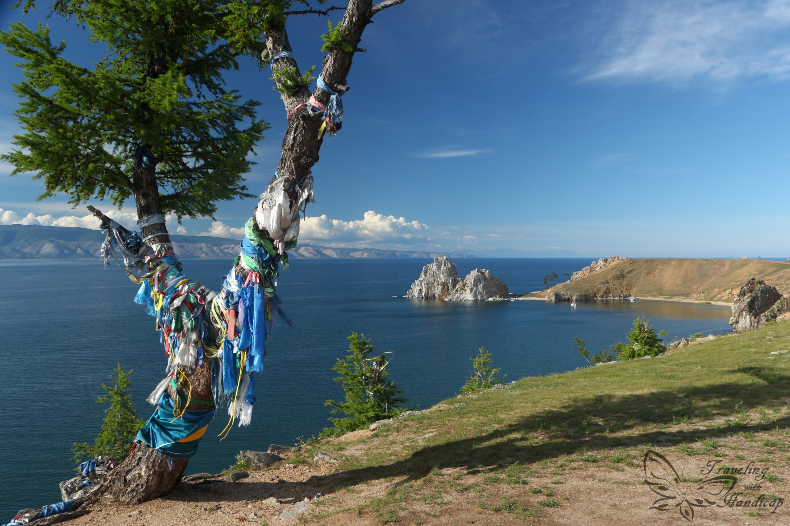
Patagonia is the name of the region covering the southern part of South America. Only the very last tip is called Tierra del Fuego (not strictly included or excluded of Patagonia). It’s a region, neither country-specific nor a political district. The Chilean part of Patagonia consists of two main regions, the glacier-region in the south (los glaciares) and the lakes’ region (los lagos) in the north. Most of Argentinean Patagonia is just brown and dry. This is because all the clouds empty out their gates over the Andes, within Chile. So a lot of rain and snow comes down in Chile, not leaving much for Argentina.
I only visited El Calafate and El Chaltén within southern Patagonia on Argentinean side because the rest is only vast and dry. For me, the view from the bus was sufficient to get an impression, without staying at a village somewhere in nowhere. I’ve seen many Guanacos along the way, also skeletons of dead ones. There are not many plants growing, the highest bush one can encounter is the Calafate, the berry of the region (southern Patagonia).
Border crossings on land
There are a few cool spots in Argentinean Patagonia, though, where the Chilean-Argentinean border is a little further down into the Andes. Within the region of los glaciares, the Argentinean mountain-hubs are El Calafate and El Chaltén. El Calafate has an airport with good connections to both Ushuaia and Buenos Aires. Many Argentina travelers take these routes. El Chaltén is a three hours bus trip away from El Calafate with multiple connections each day (during high season Dec – Feb).
Similar to my way down south from Puerto Natales/ Punta Arenas to Ushuaia, I had to cross the border from Chile to Argentina north of Puerto Natales. There is also another option/ route coming from Ushuaia, however, I picked this route because its bus schedule fitted better into my day/night needs. This border is not too busy, both the Chilean and Argentinean offices are connected through a dirt/gravel road and super tiny. Somehow this was cute. 😀


El Calafate and the Glaciar Perito Moreno
Traveling to El Calafate and El Chaltén
Many travelers enter and/or leave through El Calafate, since there is a tiny airport for domestic flights. Moreover, buses from down south enter El Calafate. If one wants to continue to up north, respective buses enter/leave El Chaltén. Respective destinations are long distance and often booked out for week(s) during high season.
So whenever you consider going there, reserve your bus tickets in advance. Be sure to have your accommodation reserved for all days. I heard of people who were stuck in El Calafate (towards Ushuaia) or El Chaltén (to Bariloche) because the daily connections were booked out for more than a week.
El Calafate
El Calafate is a small city within Argentinean south Patagonia. There is only one main road with good restaurants, stores, supermarkets etc. To me, the main road had some “Western touch” since the mountains in the background were dry and brown and the houses represented some “pioneer spirit”. I enjoyed strolling along the main road. There were some trees in/around the city – as in/around all inhabited spaces I saw on the way – planted by humans for sun and wind protection.
Within El Calafate there is a huge hype regarding the “Ruta 40”. It’s a famous Argentinean road passing western Argentina from south to north (except Tierra del Fuego). My buses also drove along parts of Ruta 40.


Glaciar Perito Moreno
The easiest way how to visit Perito Moreno Glacier is by shuttle bus. Hostels/Hotels within El Calafate would sell bus tickets, the cheapest options are available at the bus station of El Calafate. Depending on the day of week, there are more or less shuttle buses. I went on 25th December (Christmas Day and Sunday), there was only one agency (at the bus station) selling shuttle tickets. Of course, you can drive there, however, it’s not necessary to rent a car just for that.
The bus picks many people up in the morning, so it might take one hour or more until the bus leaves El Calafate. Then, you’ll have a ~70 km drive to the Glaciar viewing area. I’ve been so lucky with the weather (I picked 25th because of the forecast). Literally no clouds, a very, very rare case. What a landscape! We could even encounter the Torres (Torres del Paine) in the further background from the road (which are in Chile).
I assume on every shuttle, the staff tries to convince you of taking the boat “to also see the third side of the glacier”. My honest opinion is, the boat trip is overrated. Firstly, it’s expensive for just 1 hr. Secondly, you do indeed see the third side – from the car/bus window on the way. And this side is comparatively short, so not much to miss. Moreover, you don’t get any closer to the glacier by boat than from the walks. The only reason for the boat would be that you would be further down on water level and might get a different perspective on the height. But that’s all about it.


Accessibility of the Perito Moreno Glacier
There are different walks, marked by different colors. There is also one walk which is wheelchair accessible. I have encountered an elevator and paths without stairs. However, I didn’t see anyone using it. One van that passed by the bus dropoff area had a wheelchair sign on it, so I assume such tours are possible – with some research and preparation.
Located within a national park, every visitor has to pay entrance fees not included in the shuttle price. With a disability, you get in for free, but the rangers don’t want you to enter alone. I don’t get why with a disability you wouldn’t be able to take care of yourself (in their understanding), honestly. I mentioned that I’m “with a bus” which was sufficient for them. Sometimes it’s quite useful to not be fluent in Spanish, then they might interpret what they need. 😉
Different walking tracks to explore the glacier
The yellow, red, green, and blue walks all consist of stairs. However, the walks are all wooden pathways with handrails, so not difficult at all. The yellow one is the first one to reach from the entrance. If you don’t have much time available, it’s a good one. The green one is just a quick route to an outer end of the red track, nothing special. I really recommend the red and blue tracks. Moreover, also spending some time at the respective viewpoints. Without the boat trip, you definitely should have time for that. Watch out for breaking ice.
Perito Moreno is not the biggest, not the broadest or highest glacier. Instead, it’s in equilibrium, which means it’s growing and ice is breaking off at its front side. The glacier grows towards the viewing tracks until the water cannot pass through anymore. Then, the water caves a tunnel into the ice and at one point the ice collapses. This is a repeated phenomenon only at Perito Moreno glaciar.
Hiking in El Chaltén
The Perito Moreno Glacier is the main reason for why people visit El Calafate (and to get out cash if needed). Three hours away (by bus), El Chaltén convinces with beautiful hikes starting directly from the village. The true reason for why El Chaltén has been founded and built, truly was to have direct access to the hikes.
El Chaltén mainly consists of hotels/hostels, restaurants, supermarkets, and some stores for the people who live there. Different to Puerto Natales and the National Park Torres del Paine, there are many professional climbers spending weeks in El Chaltén waiting for the perfect weather.
Hiking and Climbing
There are not only various hikes of different length and difficulty, the Cerro Torre massif counts as one of the world’s most difficult climbing destinations. I stuck to the hikes, of course. I picked the two famous long distance hikes to Laguna de los Tres (12 km one way) and Laguna Torre (9 km one way), doing each of them as a day hike.
There would also be an option of combining the two with two nights of camping. Then, you’d have shorter distances per day (a lot easier!) and might hike from the camp spot to Laguna de los Tres for sunrise. Camping up there is also for free. Just in case there is no accommodation option in El Chaltén and you have camping gear, get prepared for camping at amazing spots.
Furthermore, there are so many different other hikes. Long and short, most of them easily accessible, for a few with a little shuttle by minibus. You could spend weeks in El Chaltén to do all the hikes, even more weeks if you wait for the perfect weather for climbing.


Mount Fitz Roy from Laguna de los Tres and Laguna Suica
My first day of hiking was to Laguna de los Tres and Laguna Suica (next to Laguna de los Tres, but not many people know that). I could have done the same route in and out, but picked an alternative option. There is a shuttle bus available to roughly the parking of Senda El Pilar (that’s what you find on maps). Next to that parking, there is another track towards the Laguna de los Tres, following a river for some time and passes by the Mirador del Glaciar Piedras blancas.
This way, I had different paths and landscape views. Moreover, the track I picked for my way in didn’t start with a steep path. The other track starting directly from El Chaltén, my way out, has a steep part at the beginning which makes you unnecessarily tired already at the beginning of a really long day of hiking. Especially since the hardest part is the very steep last kilometer up. You really need to be fit for this one and wear good shoes. Uneven, rough, high stones, too small to use your hands, covered with loose gravel. Slipping out on the gravel was a true risk, especially on the way down.
The views were so worth all the effort! Even a fox strolled around and enjoyed the view. As a side-note, foxes are not dangerous, they are just walking away if you try to approach them. Opposite to dogs which often aggressively jump at you. So I don’t get why in some countries require foxes to be shot if they are around people…


Laguna Torre with Cerro Torre
The other long hike I did was to Laguna Torre with the Cerro Torre massif in the background. This hike was of medium difficulty not containing a difficult part like the end to Laguna de los Tres. Many hikers were running some parts, the track was indeed good for running. From my perspective, the track itself was so nice, I didn’t want to rush. Just absorbing all the views, sounds,…
Laguna Torre is not brightly blue as Laguna de los Tres or Laguna Suica, it’s rather brownish. Nevertheless, there is glaciar ice swimming in Laguna Torre which you can pick and put into your drinks. I didn’t bring any special drink, cooling my water on a warm and sunny day was still a very nice indulgence.


There are indeed plenty more hiking and climbing options than the two I did. I really wanted to hike to the Laguna de los Tres, Laguna Torre if possible (and it was). In total, I spent 4 days in El Chaltén, with more days I would have done more hikes.
During that time, I have done the two long hikes during two days of brilliant weather, because the top of the mountains is almost always covered in clouds. With more days (of good weather), I would have done other less known hikes as well.